Florida Aerial Survey Technologies has  many methods for collecting aerial survey data. Our proprietary methods and processes have been designed to ensure control over our data is maintained. Our number one priority is getting our customer accurate data.
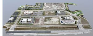
Our drone fleet is one of our primary data collection tools. We are able to leverage the power of drones to collect hundreds of thousands, in some cases millions of times more data than traditional survey methods. Not only can we collect more data but often in less time than traditional surveying and at similar tolerances.
Primarily this allows us to gather a more complete picture of our clients’ projects and job sites, saving a massive amount of our client’s time in the process. Our typical turnaround time for a 100 acre plot of land is around 100 hours from signing of a contract to execution of the job. This time frame is extended a few days if the mission is international or the job site has difficult to reach areas, but largely this is a realistic window for our company.
Not only would the 100 acre survey get produced FASTer, but it would also yield for a 200 million point deliverable. We would then use this in CAD to create highly accurate models for your company and project.
We have our 150/150 objective that sets our standard time table for turnarounds at 150 hours for jobs 150 acres and under. We gather our data using drone based surveying methods. That fact is the primary reason we can offer such rapid and groundbreaking service.
Our drones are flown by exceptional pilots capable of flying hundreds of acres per day and relaying that data back to our processing staff that verify it and transform it into the deliverables we hand our clients. This process was perfected over the course of many years of studying the technology, learning how it works, and designing a program that is rapidly executable, repeatable, and reliable. We look forward to putting that expertise to good use for our clients.
many methods for collecting aerial survey data. Our proprietary methods and processes have been designed to ensure control over our data is maintained. Our number one priority is getting our customer accurate data.
Our drone fleet is one of our primary data collection tools. We are able to leverage the power of drones to collect hundreds of thousands, in some cases millions of times more data than traditional survey methods. Not only can we collect more data but often in less time than traditional surveying and at similar tolerances.
Primarily this allows us to gather a more complete picture of our clients’ projects and job sites, saving a massive amount of our client’s time in the process. Our typical turnaround time for a 100 acre plot of land is around 100 hours from signing of a contract to execution of the job. This time frame is extended a few days if the mission is international or the job site has difficult to reach areas, but largely this is a realistic window for our company.
Not only would the 100 acre survey get produced FASTer, but it would also yield for a 200 million point deliverable. We would then use this in CAD to create highly accurate models for your company and project.
We have our 150/150 objective that sets our standard time table for turnarounds at 150 hours for jobs 150 acres and under. We gather our data using drone based surveying methods. That fact is the primary reason we can offer such rapid and groundbreaking service.
Our drones are flown by exceptional pilots capable of flying hundreds of acres per day and relaying that data back to our processing staff that verify it and transform it into the deliverables we hand our clients. This process was perfected over the course of many years of studying the technology, learning how it works, and designing a program that is rapidly executable, repeatable, and reliable. We look forward to putting that expertise to good use for our clients.
 many methods for collecting aerial survey data. Our proprietary methods and processes have been designed to ensure control over our data is maintained. Our number one priority is getting our customer accurate data.
Our drone fleet is one of our primary data collection tools. We are able to leverage the power of drones to collect hundreds of thousands, in some cases millions of times more data than traditional survey methods. Not only can we collect more data but often in less time than traditional surveying and at similar tolerances.
Primarily this allows us to gather a more complete picture of our clients’ projects and job sites, saving a massive amount of our client’s time in the process. Our typical turnaround time for a 100 acre plot of land is around 100 hours from signing of a contract to execution of the job. This time frame is extended a few days if the mission is international or the job site has difficult to reach areas, but largely this is a realistic window for our company.
Not only would the 100 acre survey get produced FASTer, but it would also yield for a 200 million point deliverable. We would then use this in CAD to create highly accurate models for your company and project.
We have our 150/150 objective that sets our standard time table for turnarounds at 150 hours for jobs 150 acres and under. We gather our data using drone based surveying methods. That fact is the primary reason we can offer such rapid and groundbreaking service.
Our drones are flown by exceptional pilots capable of flying hundreds of acres per day and relaying that data back to our processing staff that verify it and transform it into the deliverables we hand our clients. This process was perfected over the course of many years of studying the technology, learning how it works, and designing a program that is rapidly executable, repeatable, and reliable. We look forward to putting that expertise to good use for our clients.
many methods for collecting aerial survey data. Our proprietary methods and processes have been designed to ensure control over our data is maintained. Our number one priority is getting our customer accurate data.
Our drone fleet is one of our primary data collection tools. We are able to leverage the power of drones to collect hundreds of thousands, in some cases millions of times more data than traditional survey methods. Not only can we collect more data but often in less time than traditional surveying and at similar tolerances.
Primarily this allows us to gather a more complete picture of our clients’ projects and job sites, saving a massive amount of our client’s time in the process. Our typical turnaround time for a 100 acre plot of land is around 100 hours from signing of a contract to execution of the job. This time frame is extended a few days if the mission is international or the job site has difficult to reach areas, but largely this is a realistic window for our company.
Not only would the 100 acre survey get produced FASTer, but it would also yield for a 200 million point deliverable. We would then use this in CAD to create highly accurate models for your company and project.
We have our 150/150 objective that sets our standard time table for turnarounds at 150 hours for jobs 150 acres and under. We gather our data using drone based surveying methods. That fact is the primary reason we can offer such rapid and groundbreaking service.
Our drones are flown by exceptional pilots capable of flying hundreds of acres per day and relaying that data back to our processing staff that verify it and transform it into the deliverables we hand our clients. This process was perfected over the course of many years of studying the technology, learning how it works, and designing a program that is rapidly executable, repeatable, and reliable. We look forward to putting that expertise to good use for our clients. 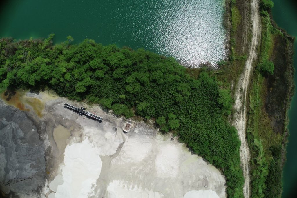
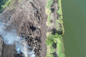
3 Ways Stockpile Measurements Help Mining And Quarry Companies
Mining and quarry companies can benefit immensely by using technology, specifically drone technology, to perform …
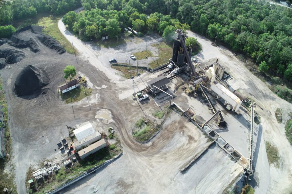
3 Ways Measuring Stockpiles Help Asphalt Plants
It wasn’t long ago that measuring asphalt and raw aggregate stockpiles required a small team …
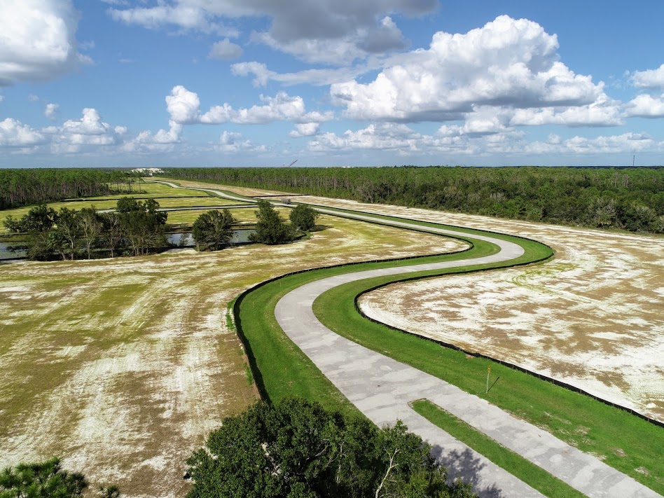
How Topographic Maps Are Used
Before we describe how topographic maps are used, let’s define what a topographic map is. …
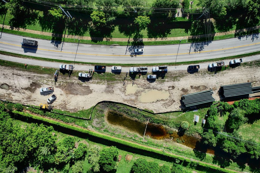
How Can Drones Be Used for Topographic Mapping?
Topographic Mapping with Drones In the past, creating topographic maps could be a laborious task …