Many people ask us “How much does an aerial survey cost.” We are an aerial surveying company after all. Unfortunately, the answer isn’t straight forward though we wish it was. The simple answer is “it depends.” It depends on the size of the project, the scope of the survey, the tolerances required, and the technology needed to get the job done properly. Generally speaking, aerial surveying costs between $30 and $120 per acre.
How sizeeffects pricing
Like many other services, base costs are driven by fixed processes associated with each aerial surveying project. Regardless of job size we have to setup file structures, bill for the project, brief our crews, and plan logistics. This means that price doesn’t scale linearly. In fact, pricing isn’t even a variable curve. The curve is more of an S shape. With our company, we assess a minimum fee that includes service on projects up to 15 acres.
How is pricing set above 15 acres? Larger sized projects see economies of scale, with operations in the field being lengthier. This is a good thing for us as field operations are the easier part of our job. For larger projects, we spend a larger percentage of time in the field. This means we can achieve scale pricing.
Aerial Survey Pricing Heavily Depends on Scope of Work.
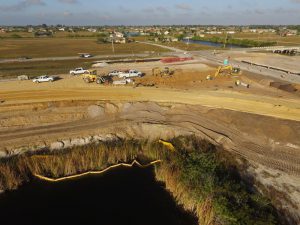
An engineer looking for a clean point cloud to use in CAD for design purposes requires a less intense scope of work compared to a developer looking to develop 100 acres. The developers scope of work will include contour maps, elevation grids, volumes, and other outputs. In other words, the developer requires an in depth scope of work, whereas the engineer is looking for one deliverable.
The developers scope of work adds significant time and cost due to the amount of work that has to be done by a skilled CAD technician.
How tolerances affect pricing
One of the biggest factors in the scope of work is the required tolerances. Customers looking for 0.1 ft tolerances, our standard, will see our standard pricing. However, some customers are looking for numbers with 1ft to 3ft tolerances, often for preliminary assessments or for rough volume calculations (our standard volume calculations are still certified to 0.1-0.2 ft tolerances.)
The tighter the tolerances, the more time is spent in the field and in the office ensuring quality of data. The processing to double and triple check the tolerances in our models takes time.
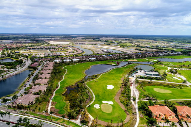
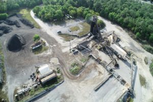
Florida Aerial Survey Technologies has experience with producing data for various asphalt companies just like this one that provided material to produce the paved areas of this golf course and the surrounding areas.
Different surveying technologies
We utilize a number of technologies to ensure our customers receive the highest quality aerial survey data. The cost of your aerial survey will obviously be effected by the various technologies required to execute the scope of work. What technologies to we employ? We use various drones with photogrammetry and LiDAR payloads. These drones often carry RTK GPS onboard. Not only do the drones cary RTK GPS, but our ground control is often set using RTK or PPK GPS. LiDAR payloads can cost upwards of $120,000 while photogrammetry payloads are more affordable in the $10,000 range.
If all of this is gibberish to you, just know that we stay up to date with the latest equipment and strive to price our services fairly while adding value to our customers’ operations.

Pingback: How New Aerial Survey Technology Helps Coastal Engineering Firms