
Aerial Topographic Surveys for Enhanced Terrain Mapping
Capture detailed terrain data using high-precision aerial topographic surveys for planning, designing, building, or verification.
Elevation Modeling you can take to the Bank
FAST captures terrain behavior and elevation variation using aerial mapping verified to control and set in local datums—ideal for layout, quantity, drainage, or grading visibility.

Golf, Coasts, & Grading
From course drainage to coastal reshaping, we deliver tenth-foot vertical accuracy for complex terrain.
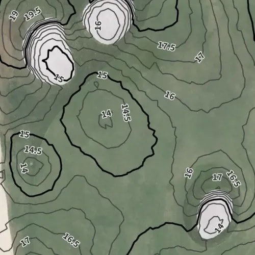
Tailored Contours
We extract breaklines and elevation layers for golf fairways, coastal buffers, or subdivisions.
Design-Ready Models
Our surfaces align with site benchmarks and GCPs—ready for CAD layouts, permits, or grading.

No Interruption, Full Context
We collect topographic data via drone and verify with 6-20 ground control points—no ground crews needed in active or sensitive areas.
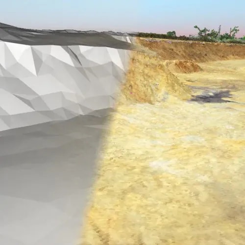
Elevation Reference from Image Capture
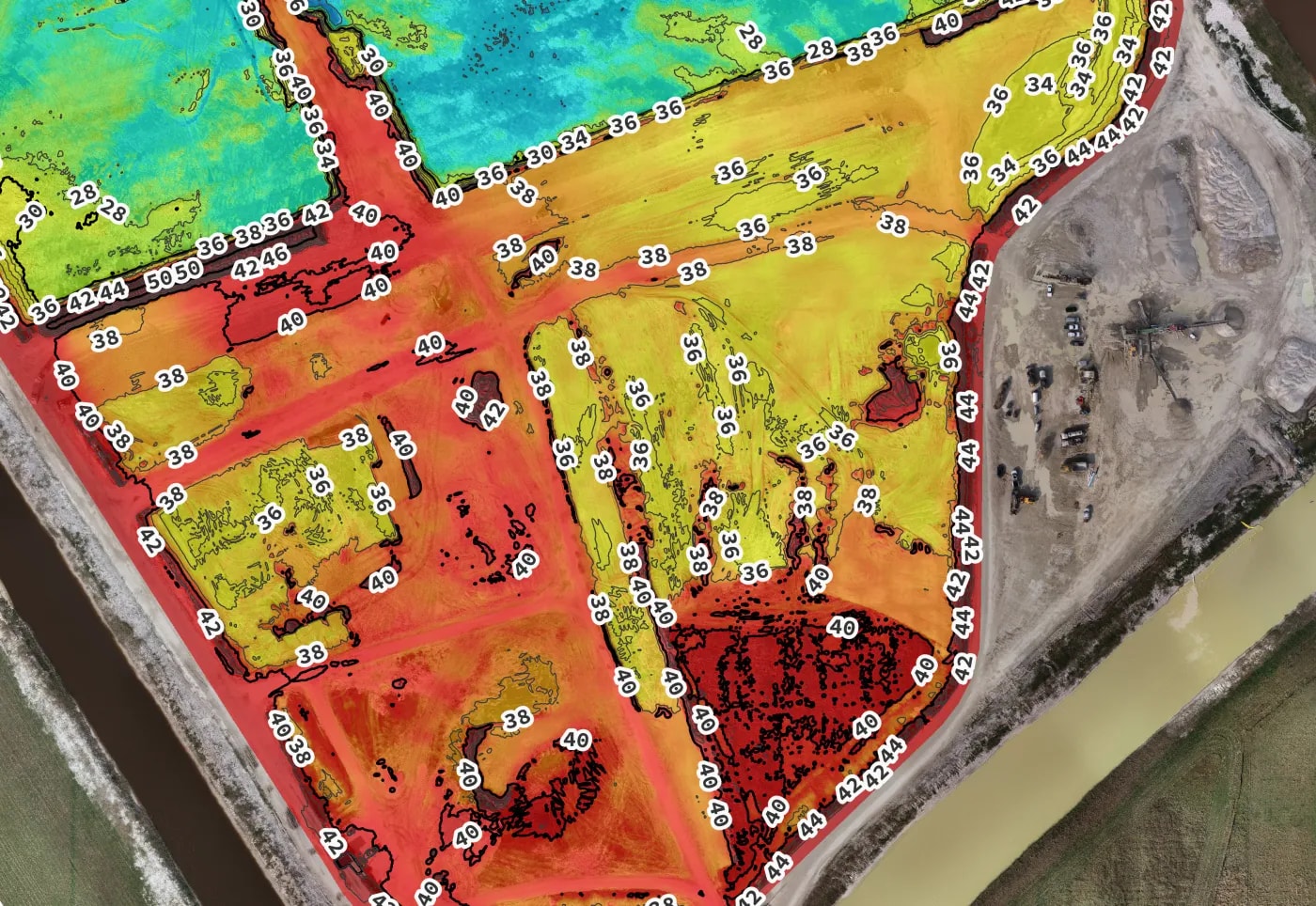
Our aerial survey process models sites via point cloud and converts them into structured elevation data and digital twins—suitable for planning projects, designing drainage and work sequence, viewing grade progress, calculating fill, and verifying quantities moved on sites.
Workflow Overview
Drone imagery captured with RTK/PPK corrections.
Photogrammetry and elevation layer generation.
Feature classification and contour modeling.
Key Metrics
≤ 0.12 US FT
Vertical accuracy verified using RTK ground control and PPK-corrected-data workflows.
1–2 weeks
Standard processing turnaround from flight to delivery with rush options available as FAST as 5 days.
Your job, your datum.
Mapped to known control or benchmarks in the datum used on your project.
Tailored to Single or Recurring Captures
Whether you need one-time elevation data or ongoing surface review, our workflows adapt to your planning schedule.
Single-Site Observation
Capture one-time elevation, surface, or layout references.
Request a One-Time SurveyRecurring Elevation Checks
Plan monthly or phase-based surveys for continued grading or surface visibility.
Talk About Recurring PlansBaseline Data for Decision-Makers
Topo Surveys offer foundational terrain intelligence for planning, permitting, or progress assessment.


Where Topo Data Powers the Design
From fast-moving subdivisions to complex coastal lots, we tailor our topographic workflows to deliver what the site — and the engineers — actually need.
FAQs About Topographic Surveys
We answer common questions about accuracy, file types, and site requirements.
With RTK/PPK and ground control, vertical accuracy is typically within 0.10-0.12 RMSE—suitable for grading, drainage, and design plans.
Contours and elevation data are structured to support grading, drainage, and layout planning. All references are geo-aligned and compatible with GIS and civil workflows.
Yes. Our process supports technical planning and civil workflows. PSM review and sign-off are standard and available for regulatory compliance. FAST carries Errors and Omissions insurance and is licensed and insured in the State of Florida to provide surveying services.